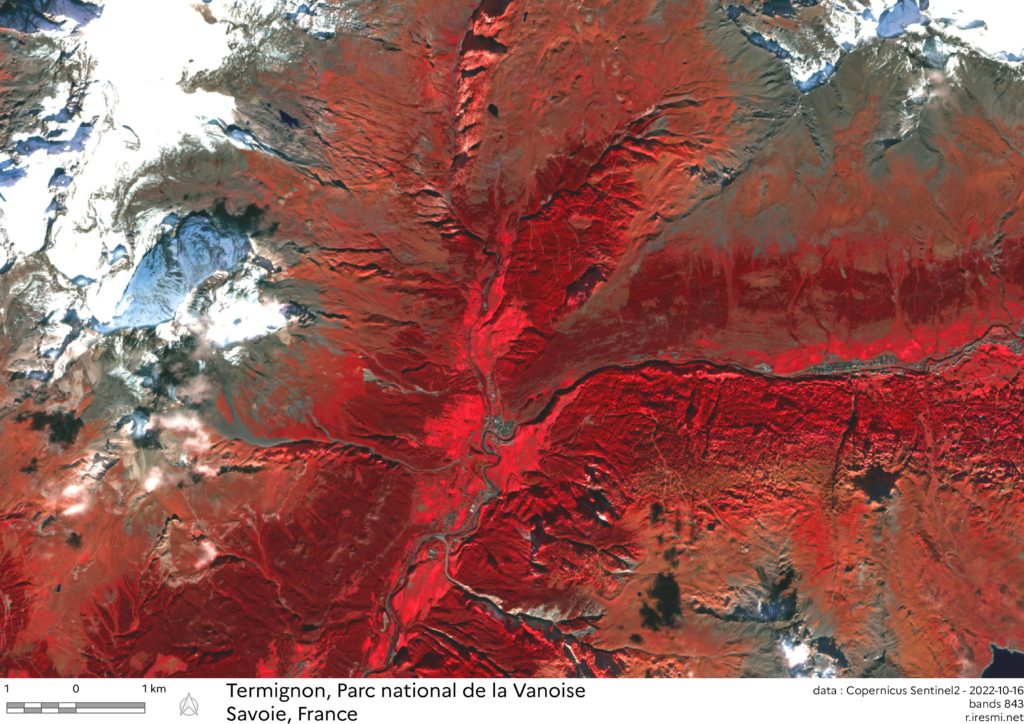
Day 11 of 30DayMapChallenge: « red » (previously).
Today no cartography in R but in QGIS. However the satellite image processing has been made with the {sen2R} package.
We emulate infrared photography with a combination of the 8, 4 and 3 bands from the Sentinel-2 satellites, aimed at Termignon in the Vanoise National Park.
Glaciers (and clouds) in white, grasslands in light red, forest in dark red, sparsely vegetated areas in brown reds and rocks in grey.