library(dplyr)
library(ggplot2)
library(sf)
library(rnaturalearth)
library(showtext)

# https://www.dafont.com/spqr.font
font_add(family = "spqr", regular = "spqr.otf")
showtext_auto()

# https://github.com/AWMC/geodata/tree/master/Cultural-Data/roads
# See also : http://awmc.unc.edu/wordpress/map-files/
roads <- read_sf("https://cdn.githubraw.com/AWMC/geodata/124b9ada1ab9031b5eede597bd24943e924232ea/Cultural-Data/roads/roads.geojson") |>
  st_transform("EPSG:3035") |>
  filter(!between(OBJECTID, 3328, 3330))

countries <- ne_countries(scale = 50, returnclass = "sf") |>
  st_transform("EPSG:3035")

extent <- roads |>
  st_buffer(100000) |>
  st_bbox()
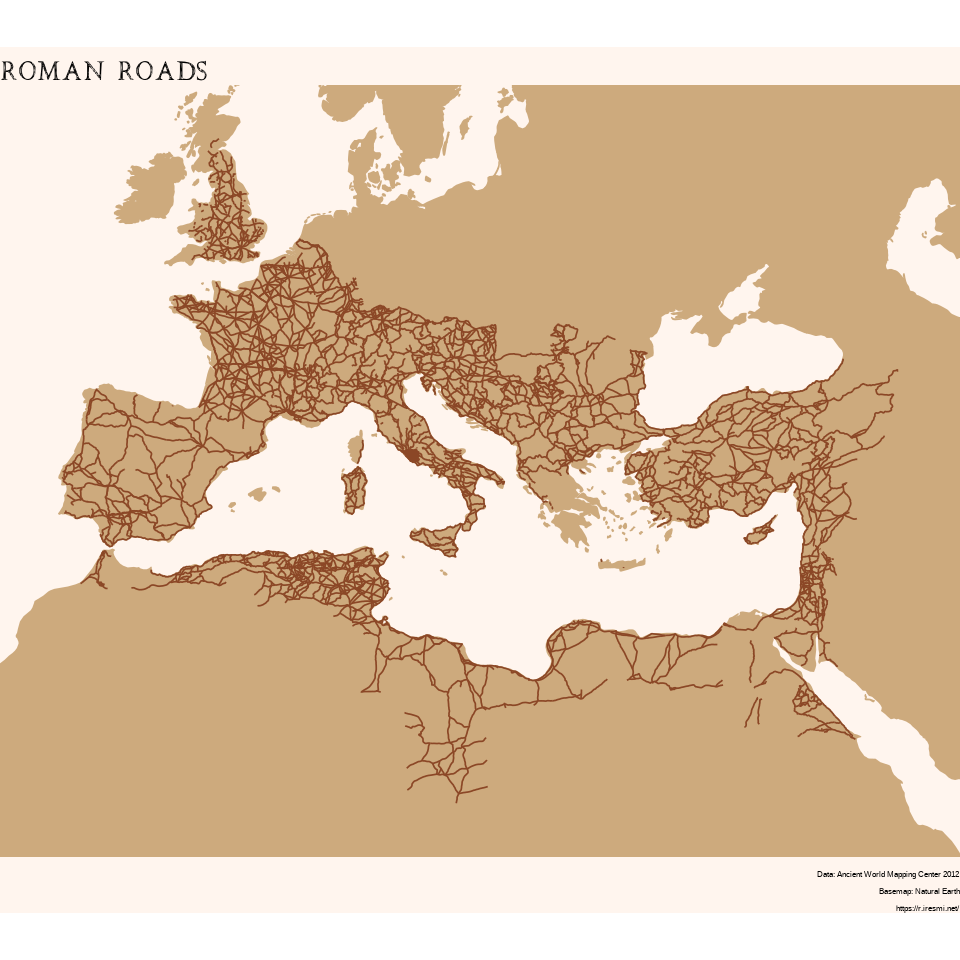
Day 11 of 30DayMapChallenge: « Retro » (previously).
Using data from Ancient World Mapping Center we map the Roman road network.
ggplot() +
  geom_sf(data = countries, color = "burlywood3", fill = "burlywood3") +
  geom_sf(data = roads, color = "sienna4", linewidth = .3) +
  coord_sf(xlim = extent[c(1, 3)], ylim = extent[c(2, 4)]) +
  labs(title = "roman roads",
       caption = "Data: Ancient World Mapping Center 2012\nBasemap: Natural Earth\nhttps://r.iresmi.net/") +
  theme_void() +
  theme(panel.background = element_rect(fill = "seashell1", color = NA),
        plot.background = element_rect(fill = "seashell1", color = NA),
        plot.title = element_text(family = "spqr", size = 20),
        plot.caption = element_text(size = 6))