library(terra)

temperature <- rast("65361bd1333e205e6e593c9179183e4a.nc") |>
  rotate()

temperature <- temperature - 273.15
crs(temperature) <- "+proj=longlat"
temperature <- project(temperature, "+proj=eqearth")Day 6 of 30DayMapChallenge: « Raster » (previously).
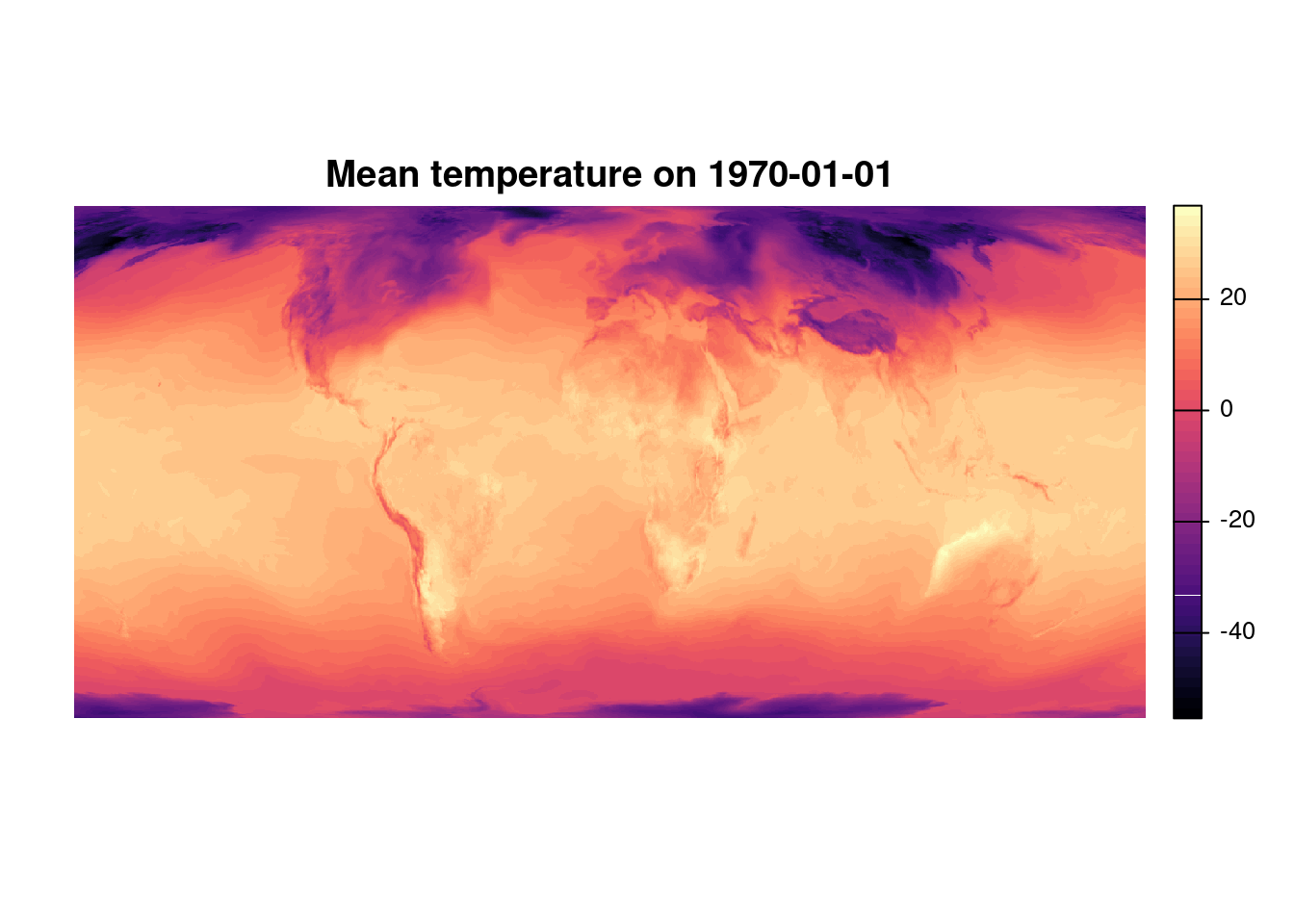
What was the temperature at your birth place when you were born?
Copernicus provides many climate datasets. We can use ERA5 post-processed daily statistics on single levels from 1940 to present to display the weather on your birth date.
Some packages help to download and manipulate ERA5 data ({KrigR}, {Ag5Tools}, {ecmwfr}, or directly by the CDS API,…) but for this one shot, we’ll do a manual download from the web interface.
You need to create a (free) account first.
Then we can chose the product:
- Reanalysis
- 2m temperature
- Date : 1970 / January / 01 (for example)
- Daily mean
- 1-hourly
Data
Map
plot(temperature,
     main = "Mean temperature on 1970-01-01",
     axes = FALSE,
     col = map.pal("magma"),
     plg = list(title = bquote("°C"),
                cex = 0.7))
mtext("data: Copernicus ERA5", cex = 0.8, side = 1, line = .5, at = 16000000)
