library(sf)
library(ggplot2)
library(rnaturalearth)
library(glue)

world <- ne_countries() |>
st_transform("EPSG:3035")Day 19 of 30DayMapChallenge: « Projections » (previously).
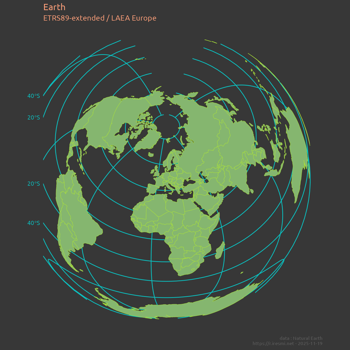
EPSG:3035 is a Lambert azimuthal equal-area projection used for mapping Europe at medium scale, preserving area. It is quite used in European statistics for this property and is the base for a grid system.
We push this projection a little further by reprojecting the entire globe.
Data
Map
world |>
  ggplot() +
  geom_sf(color = "#abe338", fill = "#85b66f") +
  labs(title = "Earth",
       subtitle = st_crs(world)$Name,
       caption = glue("data : Natural Earth
                      https://r.iresmi.net - {Sys.Date()}")) +
  theme_minimal() +
   theme(text = element_text(family = "Ubuntu",  color = "#ffa07a"),
        plot.background = element_rect(fill = "#373737", color = NA),
        panel.background = element_blank(),
        panel.grid = element_line(color = "#0ac1c1"),
        axis.text = element_text(color = "#0ac1c1"),
        plot.caption = element_text(size = 7, color = "grey40"))
