library(terra)
library(sf)

terraOptions(progress=0)
Day 5 of 30DayMapChallenge: « Earth » (previously).
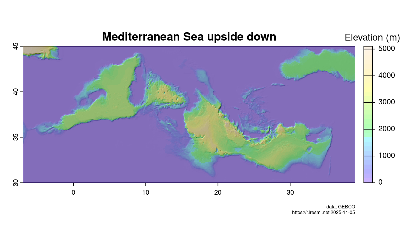
What if the bathymetry of the Mediterranean Sea is reversed? We would get a Western Island and an Eastern Island, a Sardinia-Corsica Bay, the Balearic Lagoon… Let’s see!
A global bathymetry dataset (7.5 Go zipped NetCDF) is available at GEBCO. We crop it around the Mediterranean Sea.
med <- c(xmin = -7, ymin = 30, xmax = 39,  ymax = 45) |>
  st_bbox() |>
  st_as_sfc()

gebco <- rast("~/data/gebco/GEBCO_2025_sub_ice.nc") |>
  crop(med)
We set all positive values to 0 and all negative values are inversed. The relief is more pronounced with a lightly lower resolution, then we compute the hillshading.
mountain_med <- aggregate((gebco <= 0) * -1 * gebco, 10, mean)
slope <- terrain(mountain_med, "slope", unit = "radians")
aspect <- terrain(mountain_med, "aspect", unit = "radians")
hill <- shade(slope, aspect, angle = 45, direction = 315, normalize = TRUE)
Map
plot(hill, col = grey(0:255/255),
     main = "Mediterranean Sea upside down",
     legend = FALSE, mar = c(2,2,2,4))
plot(mountain_med, col = topo.colors(30, alpha = 0.3),
     plg = list(title = "Elevation (m)"), add = TRUE)
mtext(paste("data: GEBCO\nhttps://r.iresmi.net", Sys.Date()),
            side = 1, line = 3, cex = 0.5, adj = 1)